Classifying Urban Greenery: A Random Forest Approach with PlanetScope Imagery
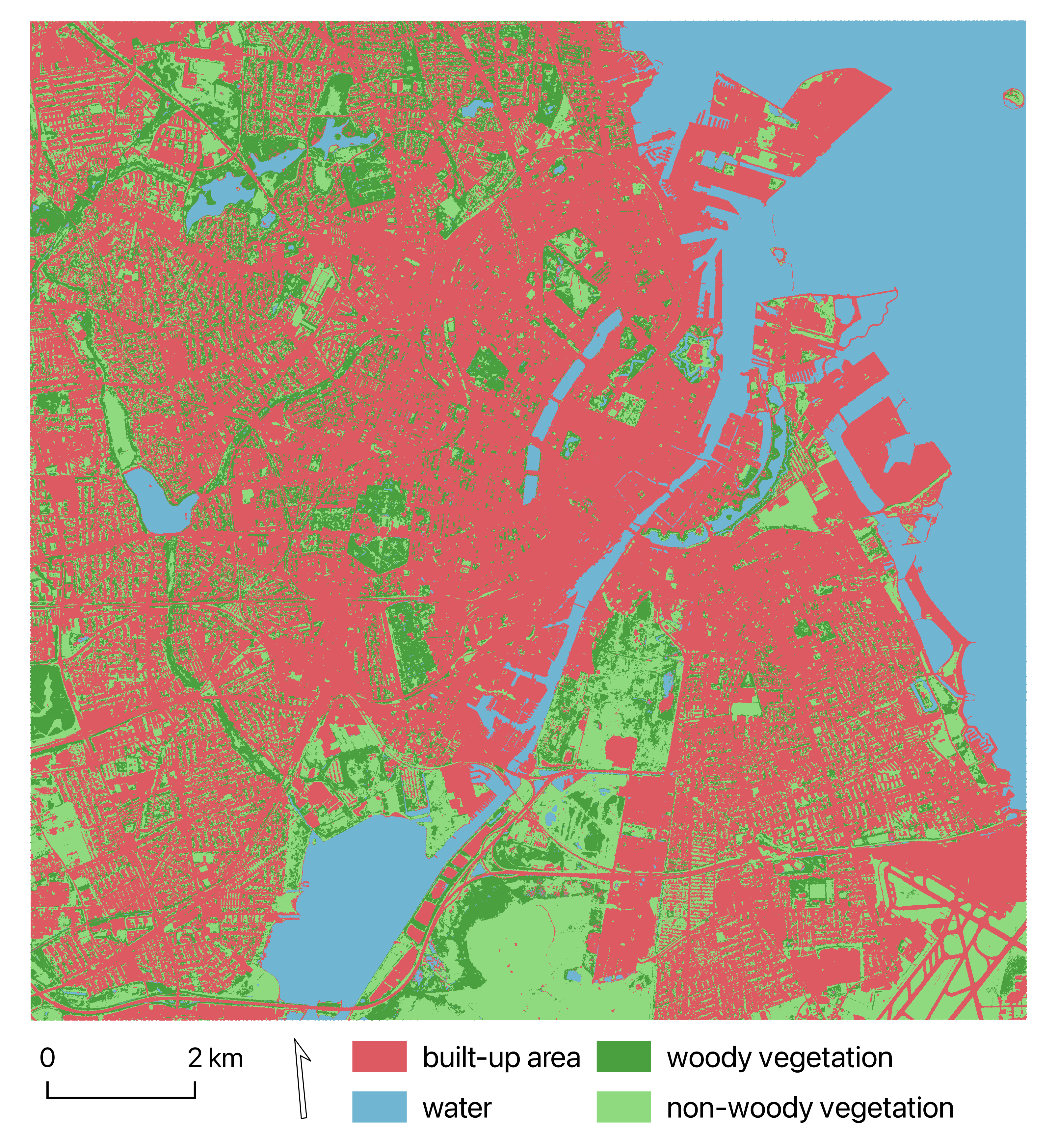
This project used high-resolution satellite imagery from PlanetScope and Danish Digital Surface Model (DSM) to create a detailed and up-to-date urban land cover classification for Copenhagen, Denmark. The project was completed together with Louise Rye Svendsen in March 2024. The code is available on my GitHub .
Overview of the methodology
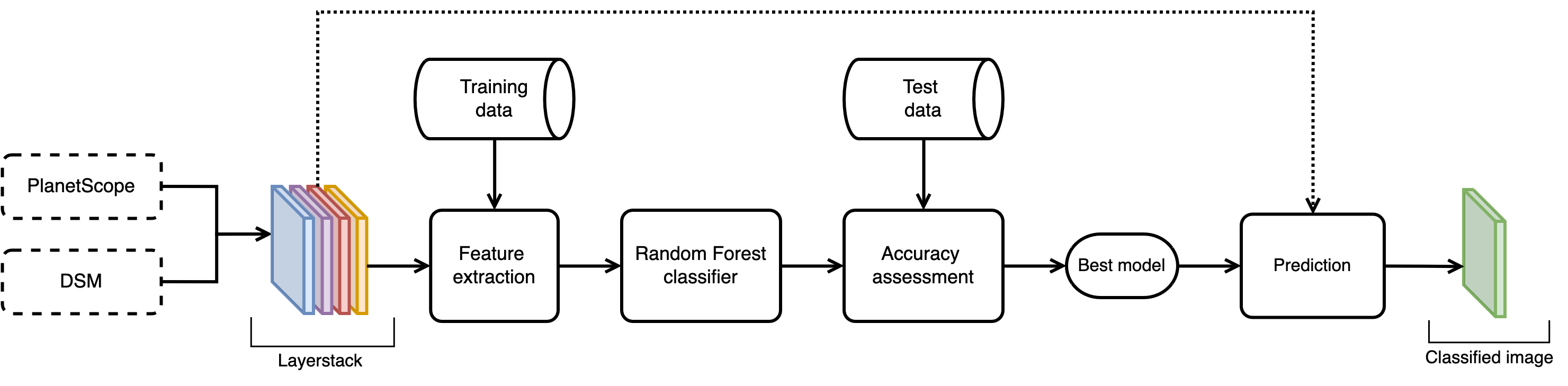
Data
| Dataset name | Spatial resolution | Date |
|---|---|---|
| PlanetScope PSB.SD | 3.7 m | 2023-05-30, 2023-07-09, 2023-09-21 |
| Digital Surface Model (DSM) | 0.4 m resampled to 3.7 m | 2016 |
The training data was labelled by the authors with four classes to represent urban land cover: built-up area, water, woody vegetation, and non-woody vegetation.
The test data was generated independently using a random sampling tool in QGIS 3.36.
Final classification